
Nature in Phetchaburi
37 natural places across 8 districts of Phetchaburi, from the forests of Kaeng Krachan to the beaches and mangroves of the coast: cave (9), beach (6), dam & reservoir (4), waterfall (4), birdwatching (3) and forest park (2), each with its fees, the best time to go and how to get there.

Thailand's largest national park and part of a World Heritage forest, with a lake above Kaeng Krachan Dam, the sea of mist on Khao Phanoen Thung, and birds and butterflies at Ban Krang.

An earth dam across the Phetchaburi River, finished in 1966, holding back a 45 km² lake dotted with islands, where you can take a longtail boat, fish, or watch the sun set behind the Tenasserim hills.

A forest campsite in Kaeng Krachan National Park at the start of the road up to Phanoen Thung, well known for birdwatching and for dry-season swarms of butterflies on the mineral licks.

A ridge-top viewpoint in Kaeng Krachan National Park known for its morning sea of mist; camp overnight in montane forest and watch the clouds fill the valleys at dawn.
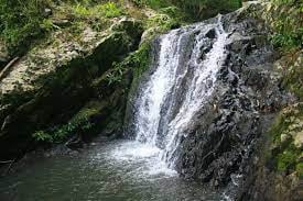
A nine-tier waterfall in shady forest about 15 km beyond Khao Phanoen Thung, reached by a 4 km walk; a good add-on for hikers camping on Phanoen Thung.
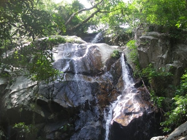
A multi-tier waterfall in the Kaeng Krachan World Heritage forest near Ban Lin Chang, Nong Ya Plong, visited on guided community treks, with a bathing pool, camping and fireflies at night by tier 8.

The stretch of the Phetchaburi River below Kaeng Krachan Dam, popular for rubber-raft trips of about 8 km with a swim stop in the cool water, lined with riverside lodges that have swimming areas.
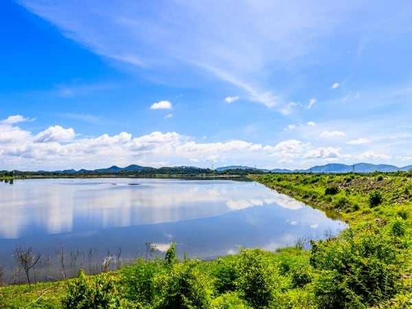
A medium-sized royal-initiative reservoir in Nong Ya Plong, where a 2 km earth dam holds back the Huai Mae Prachan stream, watering farms downstream and serving as a local place to relax.
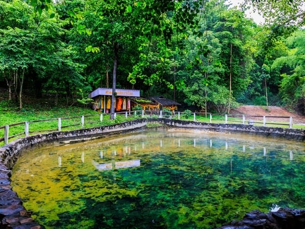
A natural hot spring among trees at Ban Phu Nam Ron, Nong Ya Plong, held sacred by villagers and open daily for a relaxing mineral soak, about 45 km from Phetchaburi town.

Cha-am's long sandy beach, about 5 km on the Gulf of Thailand, with a beachfront road, plenty of restaurants and hotels, and a long history as a favourite seaside break for Thai families.

A 622-rai strip of beach forest on Chao Lai Road, 200 m from Cha-am Beach: the last permanent forest on the Cha-am shore, with hundreds of beach-forest plants, over a hundred bird species and protected butterfly lizards.

A shady forest park on Phetkasem Road just south of Cha-am town, a long-standing rest stop between Cha-am and Hua Hin, with big trees, wildlife, an exercise area, a welfare restaurant and a camping ground.

An environment and energy learning park inside Camp Rama VI, where degraded mangrove and beach forest have been brought back, with a mangrove boardwalk trail, a bird hide and guided kayak trips.
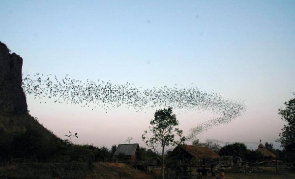
A limestone hill in Tambon Na Yang that shelters around a million bats; every evening they pour out of the cave in a ribbon more than 10 km long, watched from a village viewing area with parking and toilets.

A quiet beach in Tambon Bang Kao, about 13 km north of Cha-am Beach on the coastal road, unusual for the rows of sugar palms along the shore and its natural seaside plants.

A quiet white-sand beach between Hat Chao Samran and Cha-am, lined with casuarinas for picnics and known for its statues from the Phra Aphai Mani epic, led by the giant ogress standing out in the sea.

A limestone waterfall in Kaeng Krachan National Park on the Tha Yang side, stepping down in three umbrella-like tiers about 35 m high into an emerald pool; reached on a 2 km forest walk and flowing only in the rains.
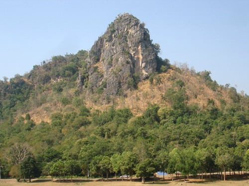
A huge limestone cave in the Khao Krapuk–Khao Tao Mo Non-Hunting Area, with throne-hall-like chambers of stalactites over four levels, reached by an 800 m nature trail where stump-tailed macaques and serows live.
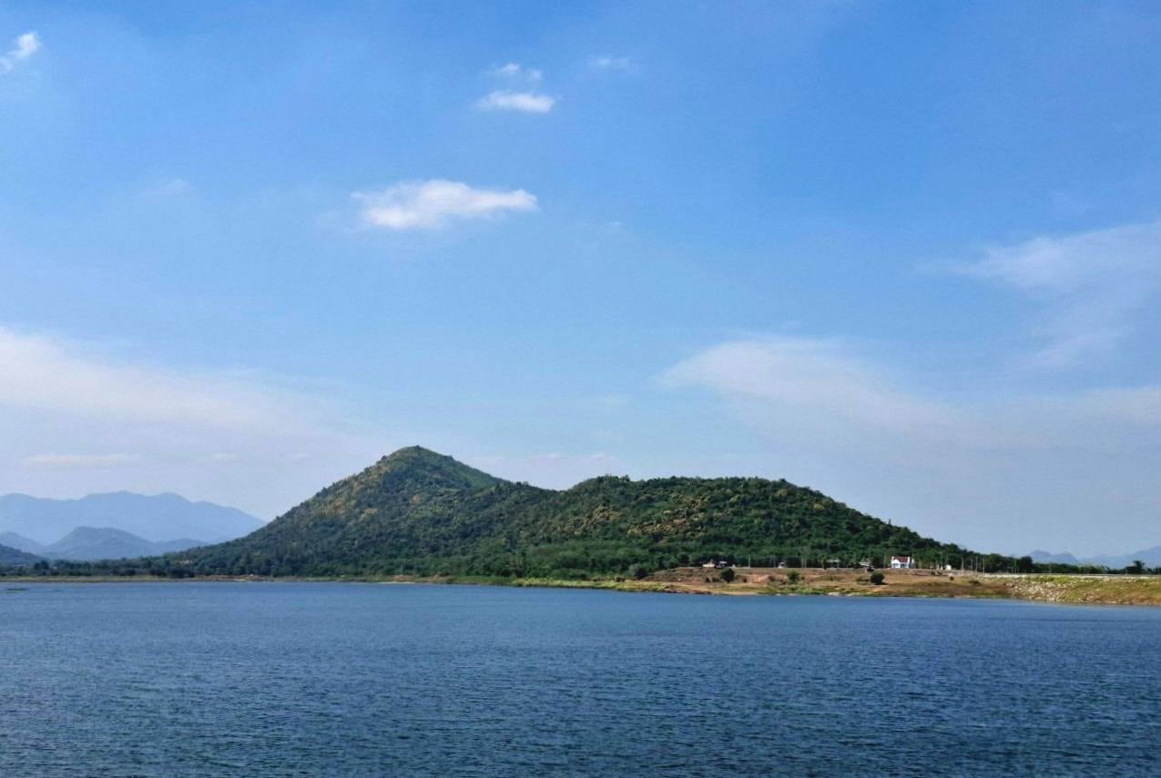
A royal-initiative reservoir at Ban Yang Chum in Tambon Klat Luang, built after King Bhumibol's 1980 visit to bring water to villages along the Huai Phak stream, and also intended as a place to relax.
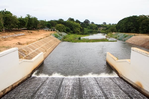
A historic diversion dam across the Phetchaburi River in Tha Yang, finished in 1950, which feeds some 336,000 rai of irrigated land and doubles as a riverside spot to relax and to learn about irrigation.

Phetchaburi's largest and best-known cave, inside Khao Luang hill just outside town, where shafts of daylight fall through openings in the roof onto halls full of old Buddha images.

A 121-metre hill in Mueang Phetchaburi dotted with caves that hold Buddha images and legends of King Suea and his teacher Phra Achan Saeng, topped by Wat Khao Bandai It and its Ayutthaya-period buildings.

Phetchaburi's long-established beach, about 15 km from town: quiet, fine for a swim and lined with restaurants and resorts, with a history that goes back to King Naresuan and King Vajiravudh (Rama VI).

A royal-initiative project that uses mangroves to clean town wastewater, with a free guided tram and an 850-metre nature trail through mangrove forest to a sea-view pavilion; Laem Phak Bia is also one of Thailand's top birding areas.

A sand spit 2–3 km long at the tip of Laem Phak Bia that separates mudflats to the north from sand beach to the south, known as the first sand of the upper Gulf of Thailand and a nesting site of the rare Malaysian plover.

The salt pans of Pak Thale are among Thailand's best-known shorebird sites; in the cool season they draw rare migrants such as the spoon-billed sandpiper and spotted greenshank, and there is a conservation plot with a bird hide.

A bay in Bang Tabun with cockle pens, coastal fishing life and mangroves, a guided mangrove study centre, and boat trips out to watch Bryde's whales feeding in the Gulf, especially from September to November.

A large limestone cave beneath Khao Yoi hill, inside Wat Tham Khao Yoi, with natural stalactites, many Buddha images including a reclining Buddha, and skylights that throw shafts of light into the main hall.

A single-chamber limestone cave at Wat Tham Rong in Ban Lat, its rock walls set with old stucco Buddha images, home to the revered Luang Pho Dam, in a village known for its sugar palms.
A limestone ridge said to be the sleeping giantess Nang Phanthurat of the Sang Thong legend, now a forest park with a nature trail past caves and story sites and bird's-eye views over Cha-am.
A cave on the small hill of Wat Cha-am Khiri, the old temple of the Cha-am community, holding Buddha images from the Ayutthaya period in a quiet, shady setting; open for visits every day.
A waterfall spilling over a stepped rock slab of more than 5 rai in the Khao Krapuk–Cha-am reserve forest near Ban Huai Hin Phloeng, with dozens of stone check dams to bathe in; it flows only in the rainy season.
Small caves in Wat Bunthawi at the southern foot of Khao Luang, with stalactites, hanging vines and Buddha images, and an old Phetchaburi legend that the cave mouth leads to the hidden city of Laplae.
A mangrove management station in Bang Khun Sai with a short 200-metre interpretive nature trail, where you can see flocks of birds, sesarmid and fiddler crabs, mudskippers and snapping shrimp.
A long sandbar off Ban Laem that appears as the tide goes out, edged by mangroves with crab-eating macaques and shorebirds, where villagers push mud sleds to gather cockles in one of Thailand's big cockle grounds.
A hilltop cave above Wat Khiri Wong in Khao Yoi, reached only on foot, where a huge chamber opens right through the mountain onto rice fields below; a finalist in TAT's Unseen New Chapters in 2023.
A forested hill rising from the plain about 16 km from Phetchaburi town, with open rock and cliff-top clearings for camping, sunrise and sunset views and paragliding; run by the Royal Forest Department as a recreational forest, free to enter.