


Kaeng Krachan National Park
อุทยานแห่งชาติแก่งกระจาน · Also: Kaeng Krachan
Thailand's largest national park and part of a World Heritage forest, with a lake above Kaeng Krachan Dam, the sea of mist on Khao Phanoen Thung, and birds and butterflies at Ban Krang.
Declared in 1981 as Thailand's 28th national park, Kaeng Krachan covers about 2,914.70 km², the largest of any park in the country, across Nong Ya Plong and Kaeng Krachan districts of Phetchaburi and Hua Hin district of Prachuap Khiri Khan. Most of it is moist evergreen forest on the Tenasserim range, the source of the Phetchaburi and Pran Buri rivers. The highest peak, Khao Ngaengnikyuaktong, rises to about 1,513 m on the Thai–Myanmar border.
On 26 July 2021 the 44th session of the World Heritage Committee inscribed the Kaeng Krachan Forest Complex – Kaeng Krachan, Kui Buri and Chaloem Phrakiat Thai Prachan national parks and Mae Nam Phachi Wildlife Sanctuary – as a natural World Heritage site for its biodiversity. The forest is home to wild elephants, gaur, banteng, tigers, tapirs, white-handed gibbons and hornbills.
The main sights on the Phetchaburi side are the lake above the dam in front of the headquarters, Ban Krang Camp, the sea-of-mist viewpoint on Khao Phanoen Thung and Tho Thip Waterfall. The headquarters has bungalows, a campsite and tents for hire, and the riverside zone about 1.5 km away, near the suspension bridge, has more bungalows. Lodging and camping are booked through the national park booking system.
Ban Krang and Khao Phanoen Thung close every year from 1 August to 31 October. When they are open, stop at the visitor centre for a pass before driving up.
When to go
Ban Krang and Khao Phanoen Thung close to visitors and campers every year from 1 August to 31 October for safety and to let the forest recover. Butterfly season at Ban Krang runs roughly March–May; the Phanoen Thung sea of mist is best from the end of the rains into the cool season.
Getting there
The headquarters is on the reservoir shore in Tambon Kaeng Krachan, about 3 km from Kaeng Krachan Dam, which is 53 km from Phetchaburi town. To go up to Ban Krang and Khao Phanoen Thung, first get a pass at the visitor centre for the Khao Sam Yot checkpoint.
- Things to do
- Sea of mistSunriseSunsetBoat tripFishingCampingBirdwatchingButterfliesWildlifeNature trail
- Facilities
- ParkingToiletsFoodVisitor centreLodgingCampsiteTents for hire
6 places to visit inside
 Dam & reservoirKaeng Krachan Dam and ReservoirAn earth dam across the Phetchaburi River, finished in 1966, holding back a 45 km² lake dotted with islands, where you can take a longtail boat, fish, or watch the sun set behind the Tenasserim hills.
 BirdwatchingBan Krang CampA forest campsite in Kaeng Krachan National Park at the start of the road up to Phanoen Thung, well known for birdwatching and for dry-season swarms of butterflies on the mineral licks.
 ViewpointKhao Phanoen Thung ViewpointA ridge-top viewpoint in Kaeng Krachan National Park known for its morning sea of mist; camp overnight in montane forest and watch the clouds fill the valleys at dawn.
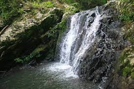 WaterfallTho Thip WaterfallA nine-tier waterfall in shady forest about 15 km beyond Khao Phanoen Thung, reached by a 4 km walk; a good add-on for hikers camping on Phanoen Thung.
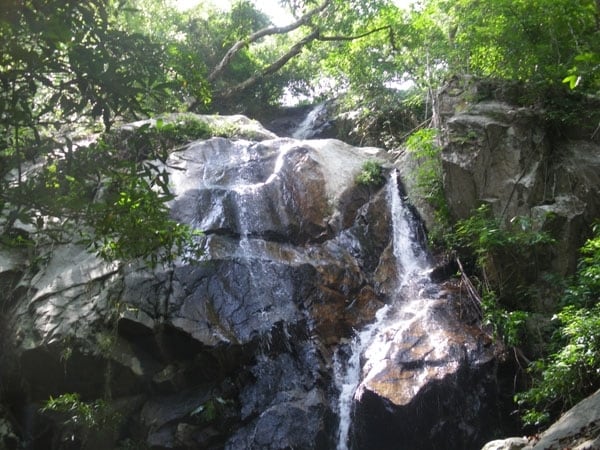 WaterfallMae Kradang La WaterfallA multi-tier waterfall in the Kaeng Krachan World Heritage forest near Ban Lin Chang, Nong Ya Plong, visited on guided community treks, with a bathing pool, camping and fireflies at night by tier 8.
 WaterfallPha Nam Yot WaterfallA limestone waterfall in Kaeng Krachan National Park on the Tha Yang side, stepping down in three umbrella-like tiers about 35 m high into an emerald pool; reached on a 2 km forest walk and flowing only in the rains.
Sources and photos
Written from the sources below, read on 30 October 2026. Fees and opening can change, so check with the managing office before you go.
- อช.แก่งกระจาน – กรมอุทยานแห่งชาติ สัตว์ป่า และพันธุ์พืช (ระบบจองที่พักและข้อมูลทั่วไป)
- อัตราค่าบริการเข้าอุทยานแห่งชาติ – กรมอุทยานแห่งชาติ สัตว์ป่า และพันธุ์พืช (data.go.th)
- อัตราค่าบริการสำหรับบุคคลในการเข้าไปในอุทยานแห่งชาติ (CSV กรมอุทยานฯ ข้อมูล 2 มิ.ย. 2566)
- อัตราค่าบริการในการนำยานพาหนะเข้าไปในอุทยานแห่งชาติ (กรมอุทยานฯ)
- อุทยานแห่งชาติแก่งกระจาน – การท่องเที่ยวแห่งประเทศไทย
- “แก่งกระจาน” กว่าจะเป็นพื้นที่มรดกโลกแห่งใหม่ – สำนักงานนโยบายและแผนทรัพยากรธรรมชาติและสิ่งแวดล้อม (24 ส.ค. 2564)
- ปักหมุด “ป่าแก่งกระจาน” ผุดจุดท่องเที่ยวมรดกโลก – Thai PBS (13 ก.ย. 2564)
- Kaeng Krachan Forest Complex – Wikidata
- อุทยานแห่งชาติแก่งกระจาน – วิกิพีเดีย
- เขื่อนแก่งกระจาน – องค์การบริหารส่วนตำบลแก่งกระจาน
- แค้มป์บ้านกร่าง – องค์การบริหารส่วนตำบลแก่งกระจาน
- เส้นทางเที่ยวผืนป่ามรดกโลกแก่งกระจาน (ททท. สำนักงานเพชรบุรี) – เดลินิวส์ (26 เม.ย. 2568)
- Map position
- Photo: Dirk Enthoven · CC BY 3.0 · Wikimedia Commons
- Photo: lopsura · CC BY 3.0 · Wikimedia Commons
- Photo: Toey19863 · CC BY-SA 3.0 · Wikimedia Commons
- Photo: KOSIN SUKHUM · CC BY-SA 4.0 · Wikimedia Commons